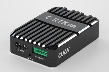
# CUAV C-RTK 9Ps
The CUAV C-RTK 9Ps (opens new window) is a multi-satellite, multi-band, centimeter-level, RTK GNSS system.
The module simultaneously receives GPS, GLONASS, Galileo and Beidou satellite signals, enabling faster positioning and higher accuracy. It also supports RTK GPS Heading using dual modules.
Using the C-RTK 9Ps gives PX4 centimeter-level positioning precision. This is ideal for survey drones, agricultural drones and other application scenarios.
# Purchase
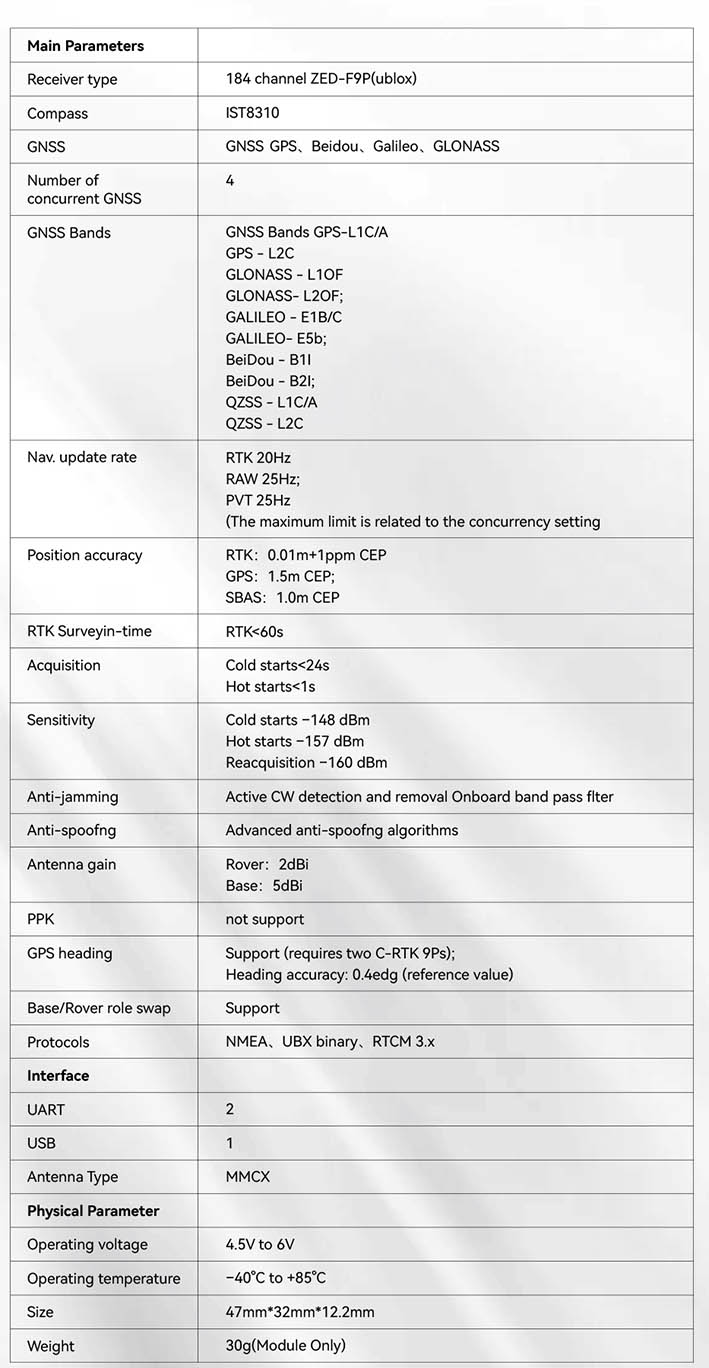
# Specification
# Wiring and Connections
C-RTK 9Ps (Base)
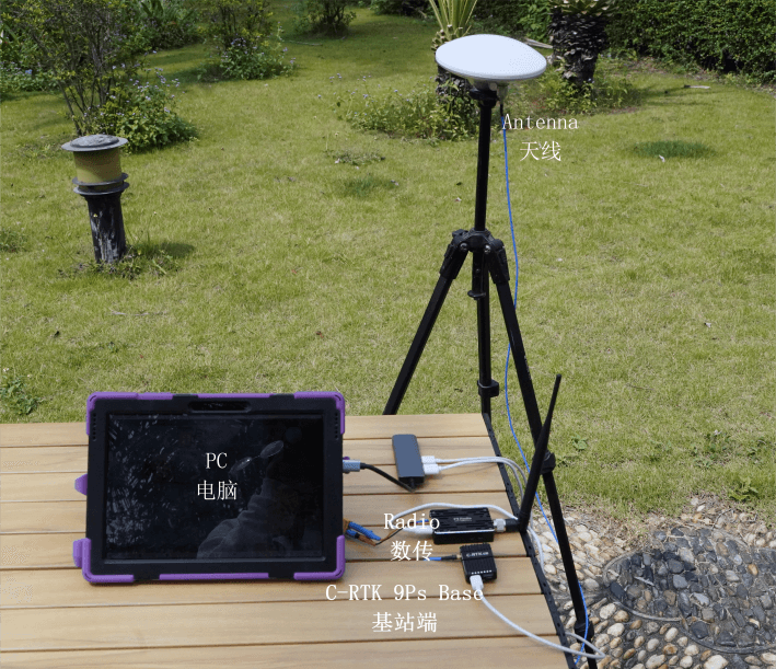
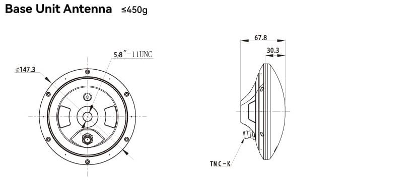
- Use a tripod to mount the base station's antenna to the top, and connect the antenna to the base station
- Connect the base station and telemetry to the computer with a usb cable.
C-RTK 9Ps (Rover)
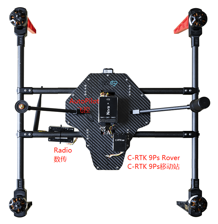
- Mount the C-RTK 9Ps (Rover) antenna vertically.
- Connect the antenna to the C-RTK 9Ps (Rover).
- Connect the C-RTK 9Ps (Rover) to the flight controller.
- Connect telemetry to the flight controller
TELEM1/TELEM2interface
Note
C-RTK 9Ps come with 6-pin and 10-pin connectors compatible with Pixhawk-standard flight controllers.
Connect to GPS1 or GPS2.
Select the appropriate cable for the flight controller.
# Configuration
RTK setup and use on PX4 via QGroundControl is largely plug and play (see RTK GPS for more information).
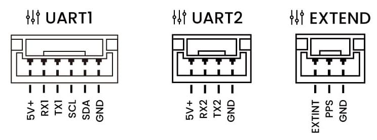
# Pinouts
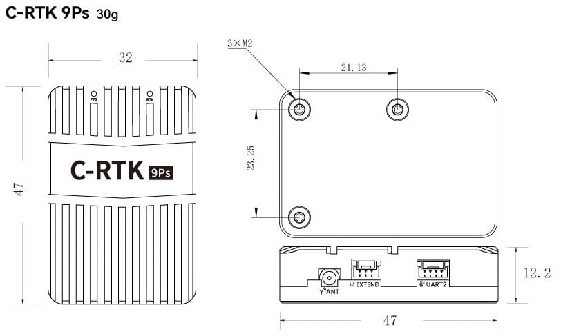
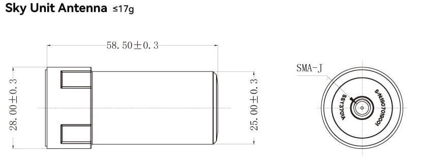
# Physical Dimensions
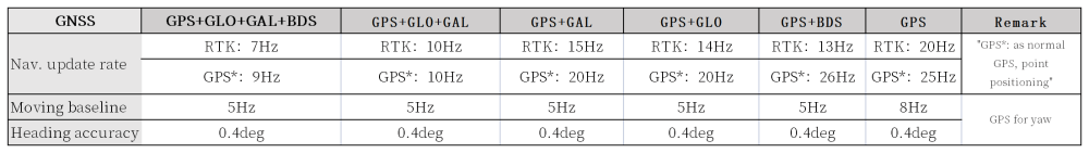
# Navigation update rates